
Mountain Building: Exploring Topography Along Plate Boundaries with GeoMapApp
Learning Objectives
The goal of this exercise is to use free, publicly-available tools and data that have been developed to make basic measurements of topography along various plate boundaries.
Standards Addressed
This activity falls within standard area 3.3.A Earth Structure, Processes and Cycles, appropriate for grade bands 6-8 as part of "Earth Features and the Processes that Change It". This exercise can be modified for higher and lower grade bands by altering the questions associated or by adjusting the amount of exploration the students do with the geomapapp.
Preparation Time Needed
1-2 hours to read through material, become acquainted with background information, and become familiar with the app. Highly recommend playing with app to make it easier to troubleshoot.
Class Time Required
Depending on how many mountain ranges you choose to examine this exercise could be one or two 45 minute class periods.
Activity Description
GeoMapApp is a free, map-based data exploration and visualization tool (see http://www.geomapapp.org). Using this tool, we can explore how comparison of topography along different boundaries, both ancient and active, can provide a means for students to grasp the immense spatial scales involved in earth processes.
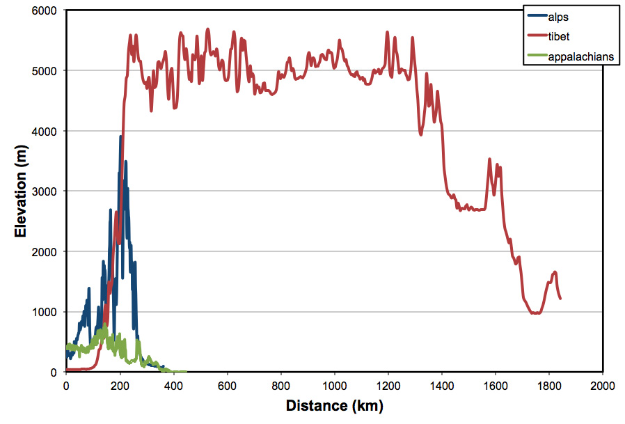
By default, GeoMapApp loads with a basemap of topographic (and bathymetric) data generated from a variety of sources. Here, I provide instructions on how to create a path and elevation profile; examine topography in active collisional mountain belts (I use the European Alps and the Himalaya/Tibetan Plateau as examples); and extract profiles across the Appalachians and the Urals. I have also included a sheet with suggested questions for making this a Claims Evidence Reasoning activity.
| Attachment | Size |
|---|---|
| 352.62 KB | |
| 16.95 KB | |
| 124.06 KB | |
| 2.57 MB | |
| 1.88 MB |